fbpx

Services

Drone Services

Technical & Cinematic Aerial Insights

AERIAL PHOTOGRAPHY & VIDEOGRAPHY

Highlight your business from a new angle shooting an overview of an event, we are here to help enhance your production value as well as offer unique and bespoke packages to suit your business needs.

CONSTRUCTION

2D maps can help provide detailed updates on the progress of a construction project since they allow you to zoom in and see different parts of the building's under construction...

MAPPING

Check out this website for many types of examples of 2D mapping. https://www.dronedeploy.com/product/gallery/ During a drone survey, we use the latest sensor technology from our high...

AERIAL DRONE SURVEYS AND INSPECTIONS

We understand the safety aspects connected to asset inspection and therefore all our flights are conducted with a full risk assessment and method statement. We can map large areas quickly.

INDUSTRIAL SERVICES

We offer flare stack inspections,external building inspections, construction site mapping, stockpile volumetric measurements and job site progress tracking.

COMMERCIAL REAL ESTATE PHOTOGRAPHY

Aerial photography has been a part of real estate marketing for a long time; however, these views have traditionally been captured from helicopters and have been reserved for only the most expensive listings.

AIRPORT & AVIATION SOLUTIONS

With our advanced drone technology, we provide airports with the benefits of using drones for everyday tasks. We can provide Runway Inspections, Respond To Emergency Documentation, Building and Hangar Inspections, Airport Infrastructure & Asset Inspection, and more.

PRESENTATION & OFFERING

Present your property to investors or clients with compelling aerial videos and photos. Showcase your property's location, major access points, popular storefronts, and parking accommodations...

FPV DRONE VIDEOS AND PHOTOS

Show your property or business in the first-person view to investors or clients with compelling aerial videos and photos. We can fly into tight areas where others can't. Or let us create a 360 immersive experience.

ADVANCED ROBOTICS SOLUTIONS

With our advanced robotics technology, we provide visuals in tight areas or confined spaces where a man can't get into. We can provide Inspections, Respond To Emergencies, Documentation, Pipe and Duct Work Inspections, Infrastructure & Asset inspections, and more.

Confined Space Inspections

We have equipment that produces high-resolution videos and photos. Inspect your property's drainage, confined space access points, tanks, vessel. piping or pipeline.

Marine Construction & Hydrographic Survey

Our marine equipment produces high-resolution models and photos. Inspect your property's drainage, lakes, ponds, points, under bridges. Hydrographic surveys

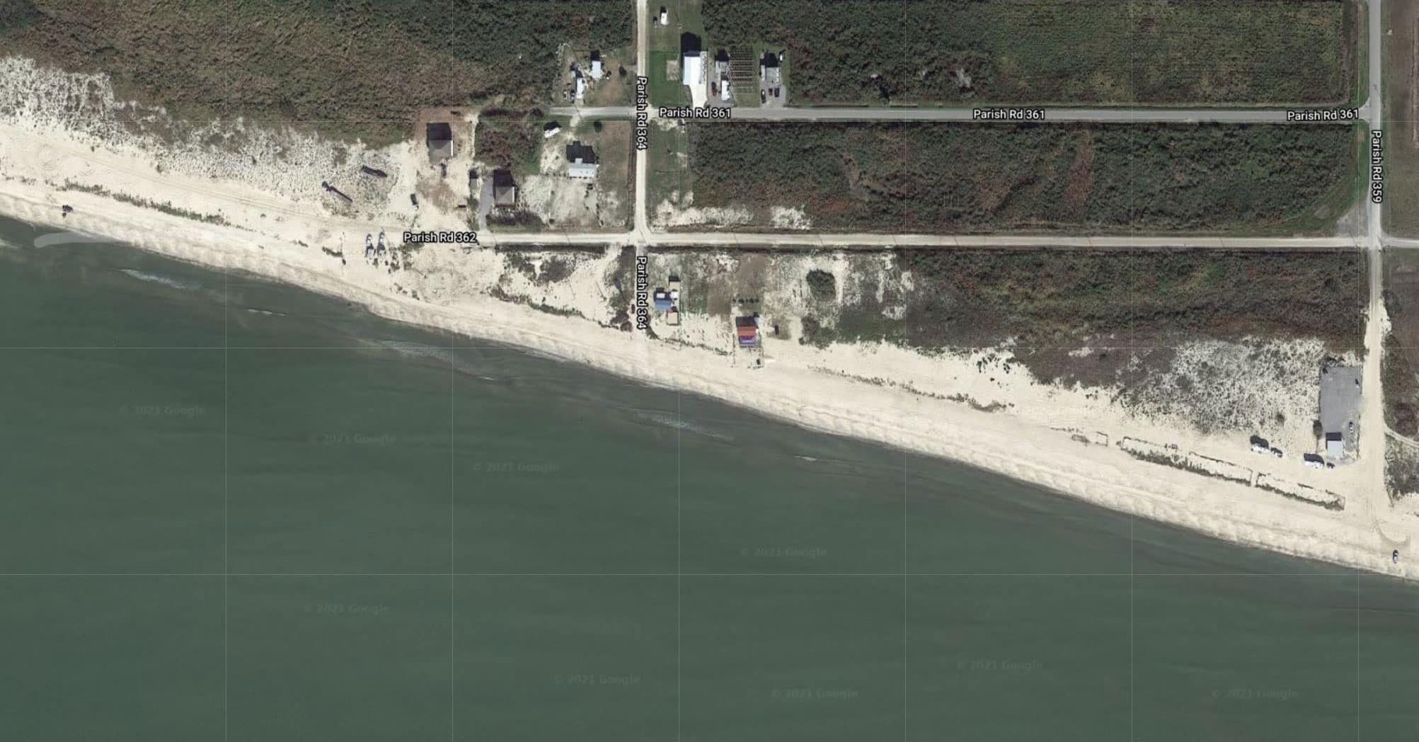
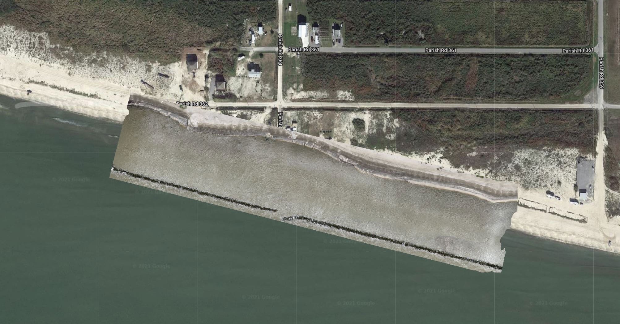
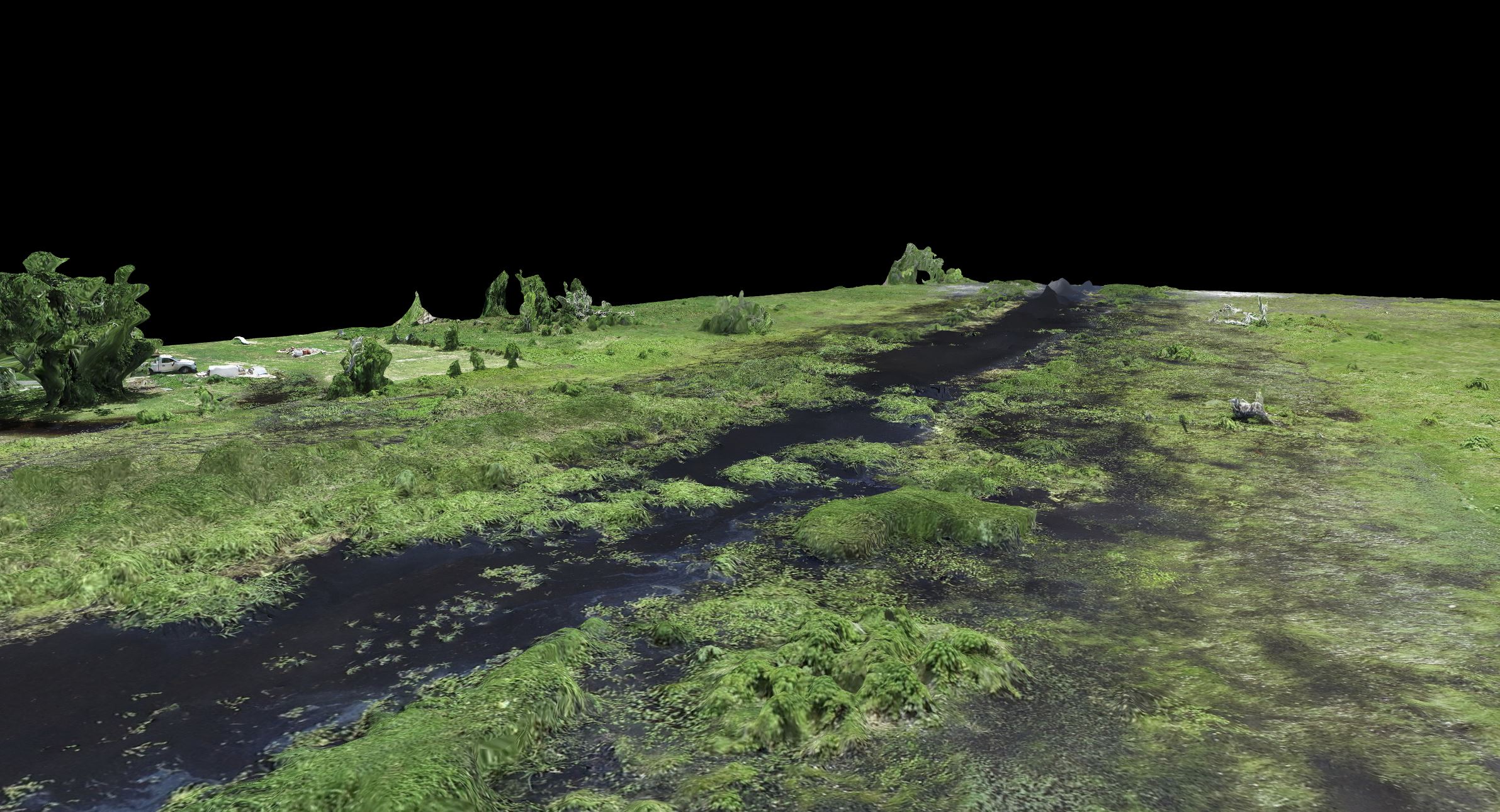
Drone Mapping Example

Our software and drone imagery generates high-resolution 2D maps and 3D models. Our aerial mapping experts can generate orthomosaic maps and 3D models, and allows us to use your maps to measure distance, area, elevation, and volume. High quality drone equipment, careful flight planning, commercial grade GPS ground control points can potentially be accurate to around 2-3cm horizontally and around 5-6cm vertically.

Before After

Dedicated Drone Pilot Service

Our dedicated drone pilot services ensure your project has consistent drone content creation. We assign your business a dedicated pilot to capture photos, video, and technical information if needed. 

Drone Maintain

Best for standard content creation.
  • Dedicated Drone Pilot
  • Photo and Video Editing
  • Two Site Visits A Month
  • High Resolution Photos and 4k Video
  • Detailed Monthly Report
  • Dedicated Storage With
    Your Files Orginized
  • Email Support Desk
    To Request Filghts
Starter

Drone Manage

Best for Clients that want
to generate lots of content weekly visits.
  • Dedicated Drone Pilot
  • Photo and Video Editing
  • Four Site Visits A Month
  • High Resolution Photos and 4k Video
  • Detailed Monthly Report
  • Dedicated Storage With
    Your Files Orginized
  • Email Support Desk
    To Request Filghts
  • Custom Reports
  • Production Strategy
Popular

Drone Master

Best for Clients that want
to generate lots of content weekly visits.
  • Dedicated Drone Pilot
  • Photo and Video Editing
  • Four Site Visits A Month
  • High Resolution Photos and 4k Video
  • Mapping 3d Rendering and Orthomosaic Photos
  • FPV Footage Of Your
    Site To Get A Person View
  • Detailed Monthly Report
  • Dedicated Storage With
    Your Files Orginized
  • Custom Client Portal To
    Access Data Quickly
  • Email Support Desk
    To Request Filghts
  • Custom Reports
  • Production Strategy
Popular

SMG AERIAL in Action

We have the technology and software to ensure you get actionable insights.

Let our experienced pilots and techs create 3d models of your site.

Hackberry Parish Drainage 3d image 3

What our Clients Says

John Doe
John Doe@username
Read More
Lorem ipsum dolor sit amet, consectetur adipiscing elit. Ut elit tellus, luctus nec ullamcorper mattis, pulvinar dapibus leo.
John Doe
John Doe@username
Read More
Lorem ipsum dolor sit amet, consectetur adipiscing elit. Ut elit tellus, luctus nec ullamcorper mattis, pulvinar dapibus leo.
John Doe
John Doe@username
Read More
Lorem ipsum dolor sit amet, consectetur adipiscing elit. Ut elit tellus, luctus nec ullamcorper mattis, pulvinar dapibus leo.
John Doe
John Doe@username
Read More
Lorem ipsum dolor sit amet, consectetur adipiscing elit. Ut elit tellus, luctus nec ullamcorper mattis, pulvinar dapibus leo.

INTERESTED TO LEARN HOW WE CAN HELP YOUR BUSINESS?

Contact Us

Get In Touch With Our Experts
Your Name(Required)
Opt in to receive text messages*(Required)